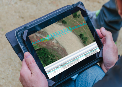
NV5 Logo Reversed White-1

18_NV5_white_RGB-lg-1

React to Risk Faster with Rapid Reporting Solutions.

Now with optional Model Conditions 

Modernize Your Infrastructure for a More Connected Future

When it comes to vegetation risk remediation and regulatory environments, utility companies face budgetary constraints in accurately assessing and managing both. NV5 recognizes that the right solution for one utility may not be right for another. Our insight, combined with our commitment to finding new ways to deliver quality remote sensing solutions and value to our clients, has led us to create our Rapid Reporting Solutions.


NV5 Rapid Reporting
As-flown Conditions 

Rapid Reporting uses lidar analytics to determine the location and proximity of vegetation and its risk to utility infrastructure at the time of data capture.

Model Conditions

In addition to quick turnaround, NV5 Rapid Reporting now offers interim model conditions analytics, providing you with maximum loading and blowout condition analysis to ensure vegetation clearance risks are not overlooked. 


Screenshot 2025-08-18 at 1.59.42 PM
Rapid Reporting Flyer

Encroachment Threats

  • 0-100kV: Threats within 10' of wire 
  • 100-200kV: Threats within 15' of wire
  • NERC, 200+kV: Threats within 25' of wire
  • Note that these parameters can be customized to your needs
AdobeStock_431412981 [Converted]

Timeline 

  • As-flown: 2-3 weeks post-acquisition 
  • Modeled Conditions: Approx. 3 additional weeks

Specs

  • Automoted Classifications
  • 3-D Model: As-flown wire positions
  • Positional Accuracy: +/- <30 cm (1 ft)
RR Data Shot-1

Deliverables

  • Encroachment locations and images
  • Assets Locations (poles & spend with unique quantum ID)
  • Detailed report of each encroachment location (Excel, PDF, ESRI)
2025_nv5-utility_logos2_xs

Why Work with an Implementation Partner?

NV5 helps utilities transition from outdated GIS systems to Esri’s Utility Network (UN). As an Esri Platinum Partner, we maintain the highest recognition for providing strategic guidance, seamless implementation, and ongoing support to ensure a smooth and efficient migration.

This means you get:
  • Seamless migration from legacy Esri Geometric Networks to Utility Network

  • Enhanced asset management and operational efficiency

  • Real-time network visibility and predictive analytics

  • Expertise in the integration with other enterprise systems including Trimble Cityworks

Don't miss us at  

TREES & UTILITIES 

in Knoxville, TN

September 9-11

NV5 - Booth #313

homepage_hero_knoxville-skyline.jpg